The next park in our Washington state tour will be Mt. Rainier National Park, a 14,410 ft active volcano that is the centerpiece of the park and the tallest mountain in the Cascade range.
This might also be the most crowded park we visit on this trip as it is a short trip from Seattle and it will be over Fourth of July weekend. The positive spin is that there will be plenty of other people to help keep the wildlife far away.
Travel
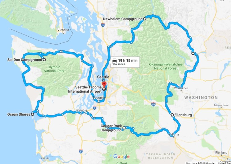
We’ll be driving from North Cascades to Mt. Rainier with an evening stop in Ellensburg to do some laundry, if needed, and shorten up the 4.5 hour drive from North Cascades to Rainier. We’ll enter the park from the southeast and start exploring as soon as we get there.
Lodging
We’ll be camping at the Cougar Rock Campground just south of Mt. Rainier at an elevation of 3,180′. Cougar Rock is right near the Paradise area of the park, which is famous for its wildflowers. It is also near some great trail heads for waterfalls and other access to some glacier viewing areas. The park is huge, but we will focus our time on the southern half which is the more “developed” area of the park making it more suitable and accessible for hiking with toddlers.

Kid factor:
Similar to what we referenced in the North Cascades planning, we have to be aware of poison ivy, bears, and carrying the extra weight of the girls. And of course, continuing the potty training success.
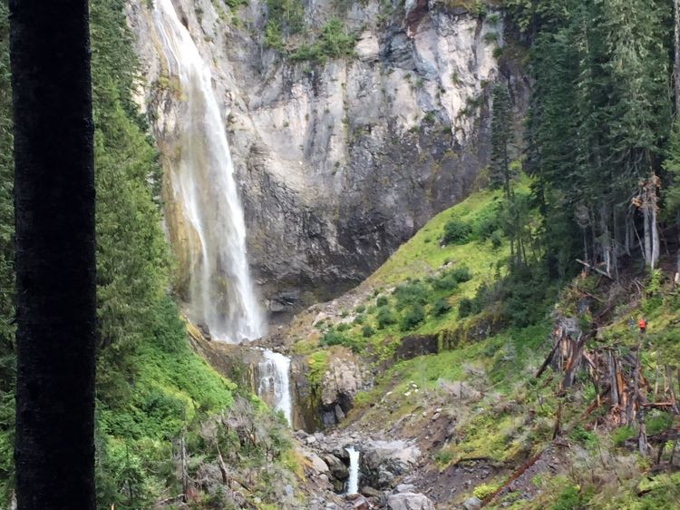
I did some digging and found a great mix of hikes that will let the girls run around while also allowing us to get a bit deeper into the park to see some great natural features: waterfalls, glaciers, tall trees, and plenty of dirt, rocks, and sticks for Quincy and Leona to play with.
Grove of the Patriarchs – 1.2 miles


Box Canyon Trail – 0.3 miles
Van Trump Park Trail to Christine Falls – 4.5 miles
Trail of the Shadows– 0.7 miles
Skyline Loop Trail – 5.3 miles

Nisqually Vista Trail – 0.9 miles
Narada Falls – 0.3 miles
Mazama Ridge to Faraway Rock – 4.4 miles
Plummer Peak via Pinnacle Peak Trail – 3.2 miles
Twin Firs Loop Trail -0.4 miles

it all looks beautiful
LikeLike